
Google Maps: Calculate route - how it works
Related Videos: how to find an estimate for the elevation of a point on Google Maps (May 2024).
With Google's map service Maps you can easily calculate a route. It even works for pedestrians or public transport. In our practical tip, we show you how to proceed.
How to calculate routes in Google Maps
Latest videos
Calculate Google Maps route

Google Maps calculate route: add travel destination, set departure and arrival time and route options
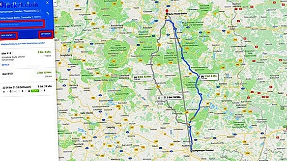
Whether in the web browser or in the mobile app from Google Maps - the route calculation is not very complicated:
- First enter the destination of your route in the displayed text field and press [Enter]. The place is then marked with a pin.
- The "Route planner" button is also displayed. Click for more options.
- You now enter the starting point of your route. This can either be a normal address or a GPS location if your device can determine it.
- Maps then calculates a route - usually for driving by car.
- You can also use the small pictograms to select a calculation for pedestrians, cyclists or public transport. For longer routes, you can also display the best route by plane
- For longer routes, you can also display the best route by plane.
- You can activate further properties for your route using the "Options" button - for example, that no motorways or toll roads should be used.
- You can also choose when you want to start, depart or arrive.
- You can also add another travel destination to your trip.
In the next practical tip, we'll show you how to calculate the straight line between two points using Google Maps.